Maps are graphic representations which show geographic information and spatial concepts.
The art of making and science of making maps is called cartography. This has been advancing by the passing of time. Some of the oldest maps are conserved in Babylonian clay tablets from about 2300 B.C. But there were many different types of them:
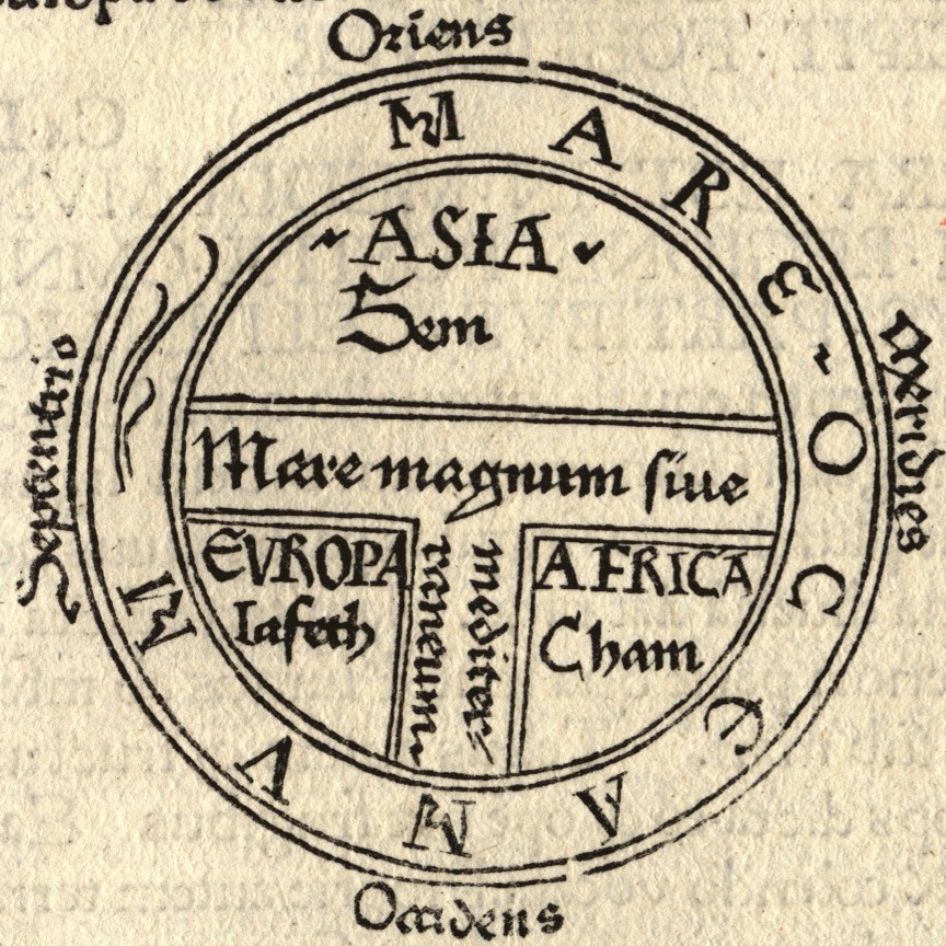
-During the Medieval period, O.T. maps were common. By this period cartography developed and maps were drawn with more realistic lines.
-In Renaissance maps started to be printed. In this period the best and most important map maker was Sebastian Münster. He developed maps of different parts of the whole world. Cartography kept developing and globes were constructed. They had a great value for economic, military and diplomatic purposes.
-Whole world maps started to appear on the 16th century. They were represented by following the voyages of Columbus. The first whole map is credited to Martin Waldseemüller in 1507.
Maps kept developing to the modern maps that were the result of pictures and illustrations. Maps took a long period of time to develop to how they are nowadays. The maps that we use don’t show us exactly how the Earth is, but they try to represent it as similar as they can with the help of the technologies we have.
HERE IS AN EXAMPLE OF AN O.T. MAP:
By: Raquel Ilas

No comments:
Post a Comment